Merritt Island Refuge

Black Point Wildlife Drive 

Location

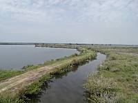
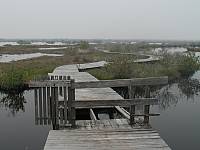
Located in north Merritt Island near Kennedy Space Center and Titusville, Florida.

Directions

From I-95 exit 80, take State Road 406 (Garden Street) and go east for about 6 miles. After you cross the Indian River bridge, you should see signs for Merritt Island Refuge. Continue following State Road 406 until it intersects with State Road 402.  

Hiking

Allan Cruickshank Memorial Trail Observation Tower

Lookout View Trail Side Gazebo

Broken Dock Broken Dock


Oak & Palm Hammock Trail Oak Hammock Kiosk 

Oak Hammock Trail

Maps

Topozone Map

An interactive topographical map of Merritt Island Refuge from TopoZone.  You can zoom in, pan in all directions and get geodetic coordinates of any point on the map. 

Terraserver Map

An interactive aerial map of Merritt Island Refuge from TerraServer. Shows the Indian River on the left, State Road 3 on the right, and State Road 402 along the bottom. Aerial photo was taken on January 26, 1999.

Flowers

Sleepy Hibiscus Seaside Gentian Saltmarsh Morning-Glory

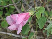
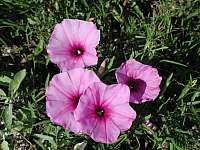
Sleepy Hibiscus, Seaside Gentian and Saltmarsh Morning-Glory

Local Weather

Click for Merritt Island, Florida Forecast

Trail Conditions

Dry Trail Conditions

Additional Information

Last updated on 13-Apr-2004 at 6:33 P.M.