Seminole State Forest consists of over 12,524 acres of land near the scenic Wekiva River Basin area. It offers many recreational opportunities for hikers, off-road bicyclist, canoeist and equestrians.
 |
 |
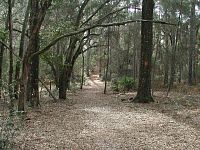
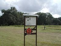
| Bear Pond Trailhead |
Seminole State Forest consists of over 12,524 acres of land near the scenic Wekiva River Basin area. It offers many recreational opportunities for hikers, off-road bicyclist, canoeist and equestrians.
Bear Pond Trailhead
Located about 15 miles west of Sanford in Lake County, Florida.
For South Entrance: From I-4 exit 51, go west on State Road 46 for about 5.7 miles. Park entrance will be on your right shortly after you cross the Wekiva River bridge. GPS Coordinates: N28° 49.152 W81° 25.685
For North Entrance: From I-4 exit 51, go west on State Road 46 for about 7.7 miles. Turn right onto County Road 46A and drive for about 5.6 miles until you reach State Road 44. Turn right on State Road 44 and go for another 4.9 miles. Park entrance will be on your right. GPS Coordinates: N28° 53.405 W81° 27.692
Park is open daily from sunrise to sundown.
$2.00 per person (children under six admitted free)
Includes all vehicle passengers, walk-ins, bicyclist and equestrians.For camping: $5.00 per night for 1-5 people, $10.00 per night for 6-10 people. For each additional person, add $1.00.
Annual Pass: $30.00
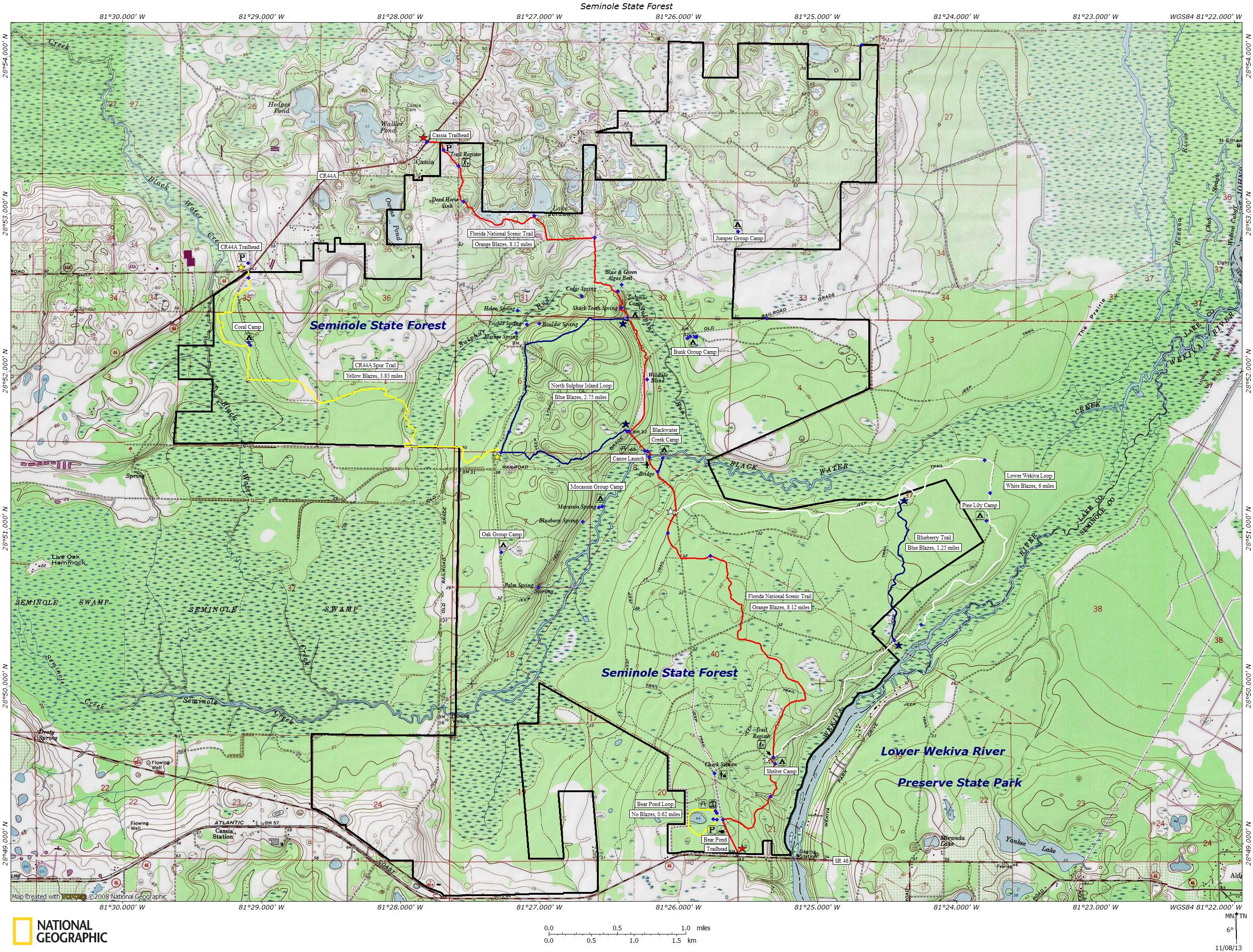
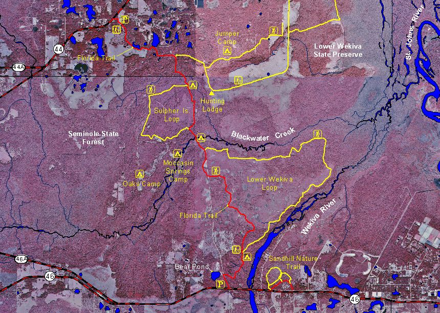
Over 22 miles of marked hiking trails are available at Seminole State Forest. The Florida National Scenic Trail (orange blazes) makes up a part of these trails and begins at the park's north entrance near Cassia off of State Road 44 and ends 8 miles later at the park's south entrance on State Road 46. Two trail loops are also available: a 11.6 mile Lower Wekiva Loop (orange & white blazes) and a 3.7 mile Sulpher Island Loop (blue & orange blazes). There's also a 3.8 mile spur trail (yellow blazes) that runs between CR 44A / SR 44 intersection and the Sulpher Island Loop. It follows the old FNST route before it was rerouted.
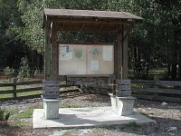
Plenty of parking is available at the trailheads. There are detailed trail maps displayed at each trailhead but unfortunately there are none that you can take with you on your hike. Bring plenty of water since there are no potable water sources at the park.
Trail signage at the north entrance. Take a good look at the map before going in.
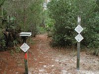
Trail registration box at south entrance of Seminole State Forest. This is also where the Lower Wekiva Loop trail begins.
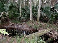
Seminole State Forest has three group campsites (Moccasin Springs, Oak & Jumper) available for reservation and require a State Forest Use Permit . Also available are four primitive campsites (Shelter, Blackwater, Sulfter and Pine Lily) along the Florida National Scenic Trail and Lower Wekiva Loop Trail. These sites are for trail users only. Each campsite is equipped with fire rings and some have picnic tables and grills.
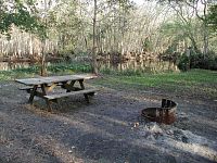
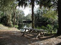
By far the prettiest of the campsites is Moccasin Springs Camp. It's located next to a tranquil little spring that flows into the nearby Blackwater Creek. It's about a quarter mile off the Sulpher Island Loop trail at coordinates N28° 51.147 W81° 26.633.
Moccasin Springs Camp The Oak Group Camp is nestled among some beautiful oak trees along Oak Pond. It's near the intersection of Sulpher Road and Loop Road at coordinates N28° 50.842 W81° 27.269.
Oak Camp
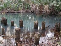
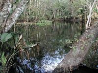
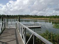
Located off of Sand Road next to the Blackwater Creek bridge is the canoe launch point at N28° 51.487 W81° 26.228. A State Forest Use Permit is required. No gasoline motors are permitted.
Blackwater Creek
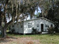
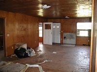
There use to be an old hunting lodge located on Oka Road near the present day Bunk Camp. The front steps were mostly rotten, but inside the place was still in pretty good shape. Sadly it burned down sometime around 2011. Even the old oak trees were destroyed.
Old Hunt Lodge
The Florida Fish and Wildlife Conservation Commission manages hunting at Seminole State Forest. For up-to-date information on regulations and current hunting schedules, please go to MyFWC.com.
Hunting Schedule 2013 - 2014 Archery Sep. 21 - 29 Mobility Imparied Oct. 18 - 20 Muzzle Gun Oct. 25 - 27 General Gun Nov. 30 - Dec. 8 Small Game Jan. 11 - 12, 18 - 19, 25 - 26 Spring Turkey Mar. 15 - 19, 22 - 26
Topo Map (large size)
Old Aerial Map
File Formats Downloads TopoGraphix ExpertGPS trails.gpx, Garmin MapSource trails.gdb, trails.mps Google Earth trails.kmz National Geographic TOPO! trails.tpo
Last updated on 23-Dec-2013