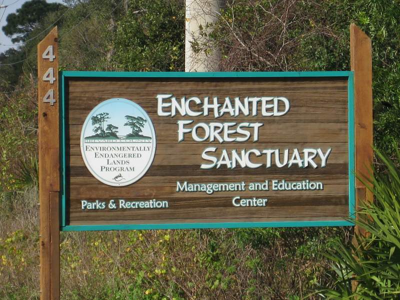

Located in North Brevard County just south of Titusville, Florida.
From I-95 (exit 79), go east on SR 50 (Cheney Hwy) until you reach the SR 405 (Columbia Blvd). Turn right on SR405 and follow road for about 4 miles. The entrance will be on your left. If you see an airstrip on your right or if you reach US Hwy 1, you've gone too far.
Tuesday - Sunday, 9:00 a.m. - 5:00 p.m.
Closed on Mondays
None
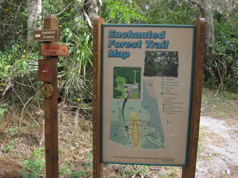
Enchanted Forest has 8 trails each with their own unique name and characteristics. If you were to connect them all together, the total distance would be about 4 miles long.
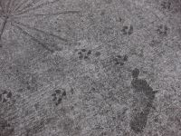
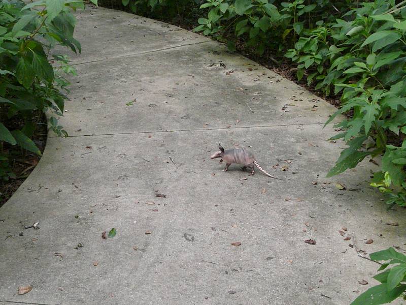
The first trail you are likely to see is the Enchanted Crossing. It's short paved path with some interesting animal tracks embedded in the concrete including a few human foot prints. Some with only one toe! The trail will take you out to an observation deck overlooking the Addison Canal.
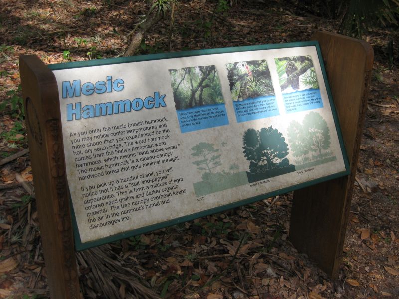
From here you can catch the beginning of the 0.7 mile Biodiversity Loop Trail. It runs east along the north bank of the Addison Canal before looping back to the visitor center. As the name implies it passes through several eco systems: dry scrub, mesic (moist) hammock and hydric (wet) hammock.

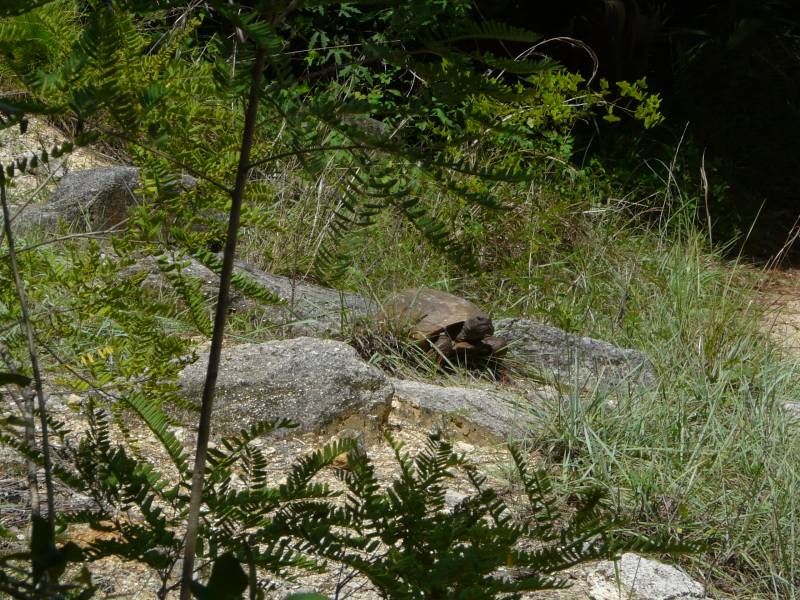
The 1.0 mile Ridge Trail, which is actually a loop, runs along a dry scrubby ridge of an ancient high dune. It was burned back in March 2007 in order to encourage fire dependent plants to grow and to open the area for scrub jays, gopher tortoises and indigo snakes. At the far south end of the trail is an old coquina quarry.
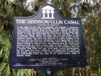

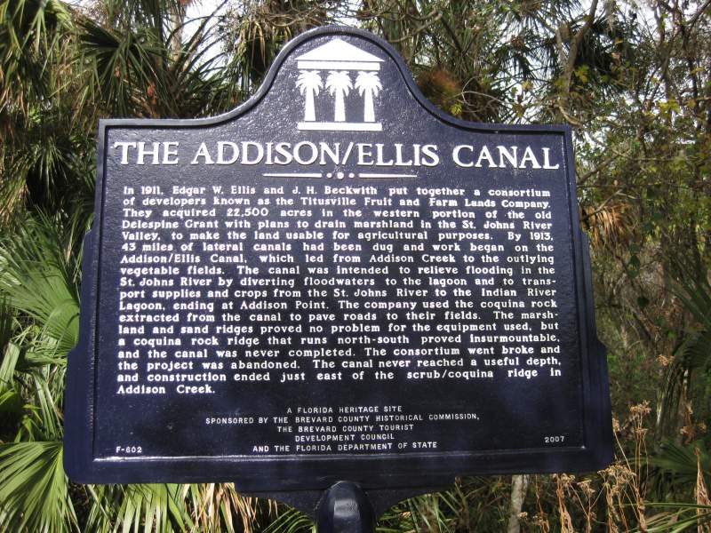
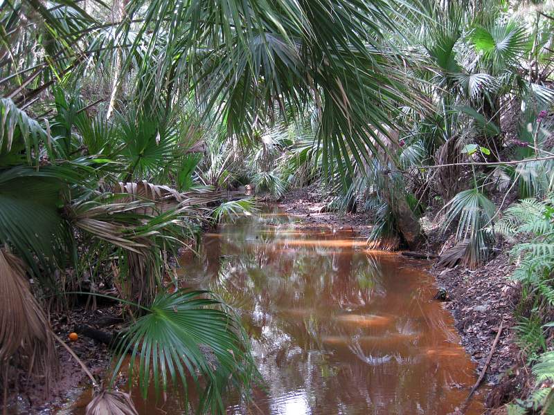
The 0.3 mile Coquina Trail crosses a bridge over the Addison Canal before turning west towards the Visitor Center. There are a number of places where you can almost stand on the edge and look down into the canal. It's quite a drop. This canal was dug between 1912 and 1913 in attempt to drain off the wetlands near the St. Johns River. Fortunately the thick coquina layer in this area put an end to that project. For more information see David Rich's Article on the Addison / Ellis canal.

The 0.3 mile Mesic Trail runs north and south through a mesic (moist) hammock. A very cool place to go to escape the hot, dry nearby scrub ridge. Here you're likely to see oak trees, wild coffee plants and even orange trees.

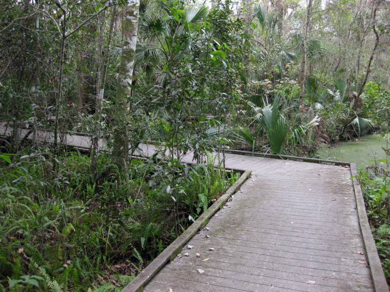
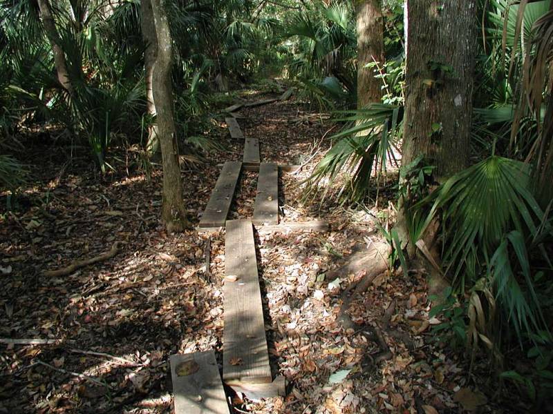
The 0.3 mile Tomoka Trail passes through mostly hydric (wet) hammock using some very impressive boardwalks. I remember when they just threw some boards on top of the mud and called it a "boardwalk".
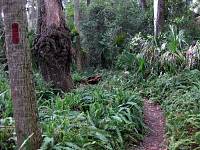
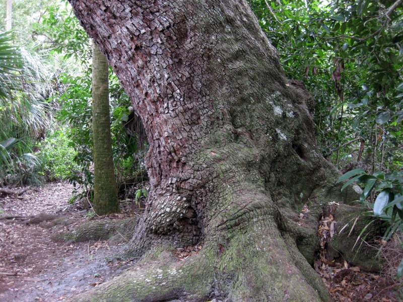
The 1.1 mile Magnolia Loop is my most favorite trail of the bunch. It's the only one that's actually blazed (red) and is a single track trail in the true sense. All the others you can practically drive a car down them. You'll see lots of tall magnolia trees, huge oak trees and plenty of ferns growing in this area. Definitely a must see if you visit the Enchanted Forest.

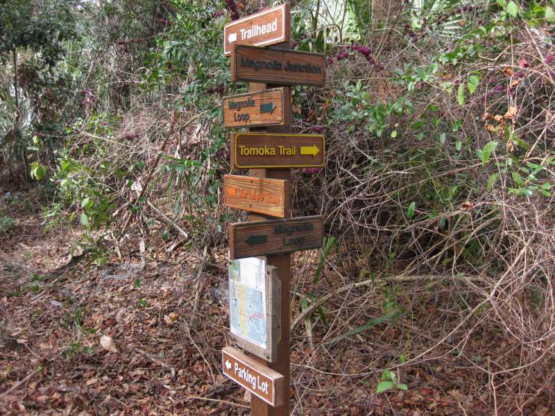
The 0.4 mile Tortoise Trail rounds out the list. It takes you back to the parking lot from Magnolia Junction, which is where the Magnolia Loop starts and ends. There's quite an impressive number of trail sign at this junction. I guess they want to make sure you don't get lost.
There's one other trail but it's closed to hikers. It's the remnants of the Hernandez-Capron Trail. It was built by Brigadier General Joseph Hernandez back in 1837 to support troop movement to the forts between St. Augustine and the Fort Pierce area. For more information see Jim Cooper's Article on the Hernandez Trail.
File Formats Downloads Garmin MapSource trails.mps TopoGraphix ExpertGPS trails.gpx Google Earth trails.kmz
Last updated on 16-Jan-2009 at 11:11 P.M.