Ocala National Forest - St. Francis Trail
These are some of the interesting sites you'll see
while hiking on the St. Francis Trail.


Pictured on the left is one the old artesian wells
located near the St. Francis historic landmark. If you don't mine the smell of
rotten eggs, there's a tiny sulfur spring (shown on the right) flowing just
off the trail. You can't miss it... just follow your nose.
Location
Located in southeast portion of the Ocala National
Forest in Lake County, Florida. Nearest city is Deland which is about 5 miles
northeast of St. Francis.
Directions
From I-4 exit 56 near Deland, go west on State
Road 44 for about 10 miles. After you cross the St. Johns River bridge, turn
right onto State Road 42 and following it for about a half mile. Turn right
onto River Forest Blvd (Forest Rd 542). Follow the dirt road until you see the
trailhead parking on your left.
Hiking
Hiking is the only way you're going to see this
trail. No bicycles, horses or motorized vehicles are permitted on the trail.
The St. Francis Trail consists of a 5.8 mile, blue blazed trail which takes
you all the way out to the St. Francis historical site on the St. Johns River.
You won't be able to see much of the old town, just a few artesian wells and
the remains of the old pier along the river. Near the trailhead you can still
see the old furrows of when the area was used to grow watermelons.
There's also a short, yellow blazed, side trail (about a half mile
long) that will take you by a small spring. The spring is only
a foot wide and a few inches deep, so don't plan on doing any scuba diving here.
Hunting
| Hunting Schedule 2009 -
2010 |
| Archery |
Sep. 26 - Oct. 25 |
| Muzzle Gun |
Oct. 30 - Nov. 1 |
| General Gun |
Nov. 12 - Jan. 10 |
| Fox, Bobcat, Raccoon |
Nov. 14 - Apr. 18 |
| Small Game |
Jan. 11 - Mar. 7 |
| Spring Turkey |
Mar. 25 - 28, Apr. 1 -4, 8 - 11, 15 - 18 |
Maps

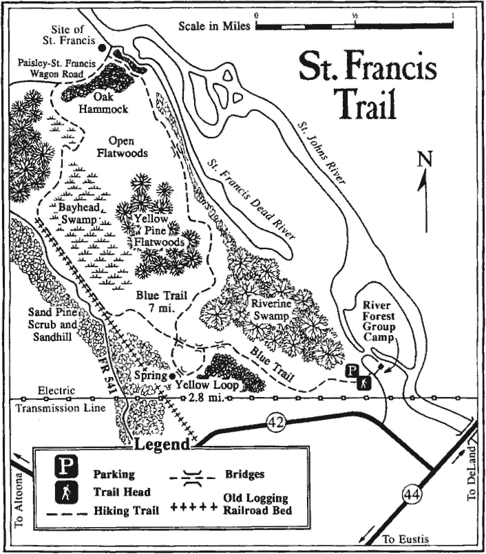
Nice detailed
map showing the St. Francis Trail.
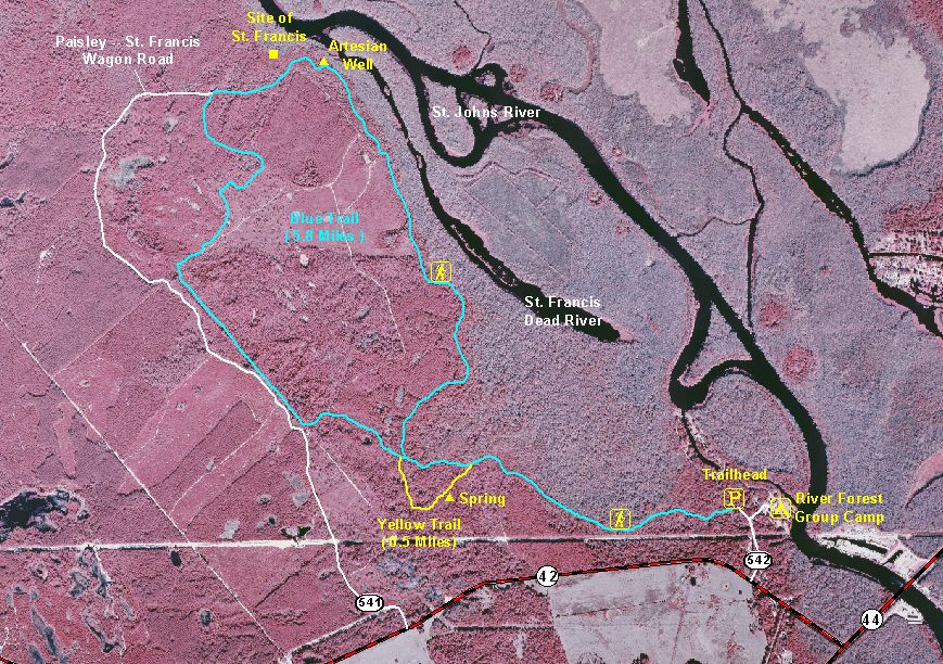
Color
infrared aerial map of St. Francis showing trails, campsites and
roads.
Interactive
aerial map of St. Francis from Terraserver.
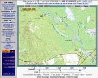
Interactive
topographical map of St. Francis from Topozone.
GPS Data
Local Weather

Trail Notes
- 19-Jan-2002: The entire trail is in
excellent shape including all the boardwalks and the bridges. The blazes are
clear and complete. No water on the trails. Just a few muddy
spots that's all.
Links
Last modified on 4-Sep-2009 at 10:17 P.M.