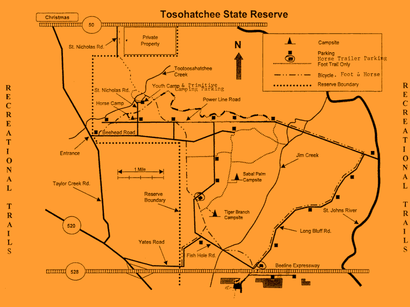
Tosohatchee Wildlife Management Area
Old Trail Notes
- 31-Jan-2004:
Fees have all gone up a buck since the beginning of the year. White
blazed hiking trails are in excellent condition. No water on the trails
except at the very end of Swamp Spur. Perfect time of the year to go
hiking. No bugs!
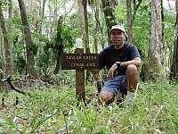
- 18-Nov-2002: Created a new Geocache site at the end of the
trail near Taylor Creek.
- 11-Nov-2002:
The FTA has recently lopped and reblazed the trails south of SR 520. I
followed up and tried to fill in some of the craters left behind by
wild pigs rooting for grubs. Also mowed the white blazed trail and the
area around the trailhead. It was looking kind of shaggy. Saw an
amazing thing while I was hiking the trails. Heard a noise
that sounded like an armadillo digging around in the leaves. Turned out
it was a 6-foot alligator walking (not crawling) through the woods.
Guess he was looking for a new water hole. Never seen anything like
that before. Also saw my first yellow jacket nest. It was located at
the base of a palm tree right next to the trail. Luckily the bees
didn't seem to be bothered by my presence.

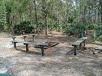
- 08-Jun-2002:
The Hoot Owl Hilton was torn down after park authorities learned it was
being used by vagrants. I'll miss that old building. It had a lot of
character. The Youth Camp has been relocated to the other
side of St. Nicholas Road. Pine beetles and the risk of
following dead trees caused the old site to be closed down.
- 03-Feb-2002: Created a new Geocache site over by the old
Bee Head Ranch complex.
- 01-Jan-2002: Road
to the Youth Camp has been temporarily closed. Looks like it's due to
pine trees being harvested in that area. Noticed a lot of hoof prints
on the Florida Trail. The ground was softened up in a few places but it
wasn't too bad. Lots of dead fall on the trail down by Jim
Creek. Not much fun if you're biking through this area.
- 04-Nov-2001:
According to a sign at the entrance, all trails are still very wet and
Fish Hole Road is closed due to flooding. A new revised trail map
is now available at the entrance. It shows the trail section north of
Tootoosahatchee Creek is now closed to bicyclist and horseback riders
but the east-west trail along Powerline Road is now open to all trail
users. The map also indicates horse trailer parking is now available at
the Beeline overpass and at a designated parking area along Fish Hole
Road.
- 19-Aug-2001:
No trail report on account of the mosquitoes being so bad. Fish Hole
Road is closed from Beehead Road to Long Bluff Road due to flooding.
Except for a few wet spots, the roads were in great shape for bike
riding.
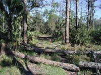
- 20-Jun-2001:
I lost count but there must have been over 20 dead pine trees
(casualties from the 1998 wildfires) lying across the trail between
Beehead Road and Jims Creek. This is one area you don't want to get
caught in during a wind storm. The old trail section south of Jims
Creek as been rerouted and it now comes out onto Fish Hole Road near
the Beeline (SR 528) overpass. Nice job! With all this rain
we've been getting, amazingly there is no standing water on the trails.
Even Jims Creek is bone dry.
- 11-Mar-2001:
I got a chance to checked out the trail section south of State Road
520. The trail is in excellent condition. There is some tree harvesting
going on near the trail head. Even though the trail
officially ends at Taylor Creek, you can still get to the
abandon trail sections on the other side of the
creek. On the day I was out there, the creek was
bone dry and you could just walk across it. The old flimsy
rope bridge has been removed. Now there's a makeshift bridge made out
of fallen trees and tie raps. I doubt it will be there after the next
rainy season. The abandoned Taylor Creek Campsite is still in pretty
good condition. The pump is capped off so you can't get water
at this location anymore. Besides being a little overgrown,
the abandon trail is still hike able all the way to the St. Johns
River. While hiking back to the parking area, I decided to
check out what was left of the old levee that used to run along the St
. Johns River between SR520 and the SR528. Years ago the
Florida Trail used to follow this levee before it was bulldozed
away. There's an "unofficial" ATV trail running
along where the levee used to be. It's looks like it may go all the way
to SR528. I think I'll come back later with my mountain bike
and check it out.
- 18-Feb-2001:
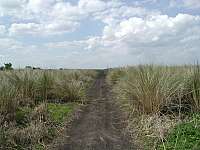
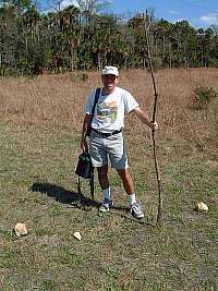
Another great day at Tosohatchee. This time I started out hiking north
from Power Line Road (that's where this picture was taken) and would
end up in Seminole Ranch (about 6 miles away and 3 hours
later). I checked out Hoot Owl Hilton along the way and got
some pictures of the inside (see above). Tosohatchee Creek is
completely dry right now. The trail registration box at the North Gate
still hasn't been replaced since the last fire that destroyed
it.
- 17-Feb-2001: All sections of the Florida Trail in
Tosohatchee are in excellent condition. The new trail route to Yates
Road should be a welcome relief to through hikers. You just
have to watch out for some of the dogs that live along that road (the
owner's don't believe in leashes). For the Florida Hands
Across The Trail (F-HATT) event, I had a chance to check out the trail
section along State Road 520. I could not find any blaze marks between
State Road 528 and James Creek Road. From James Creek Road to
Taylor Creek Road the blazes are visible but the trail is
overgrown.