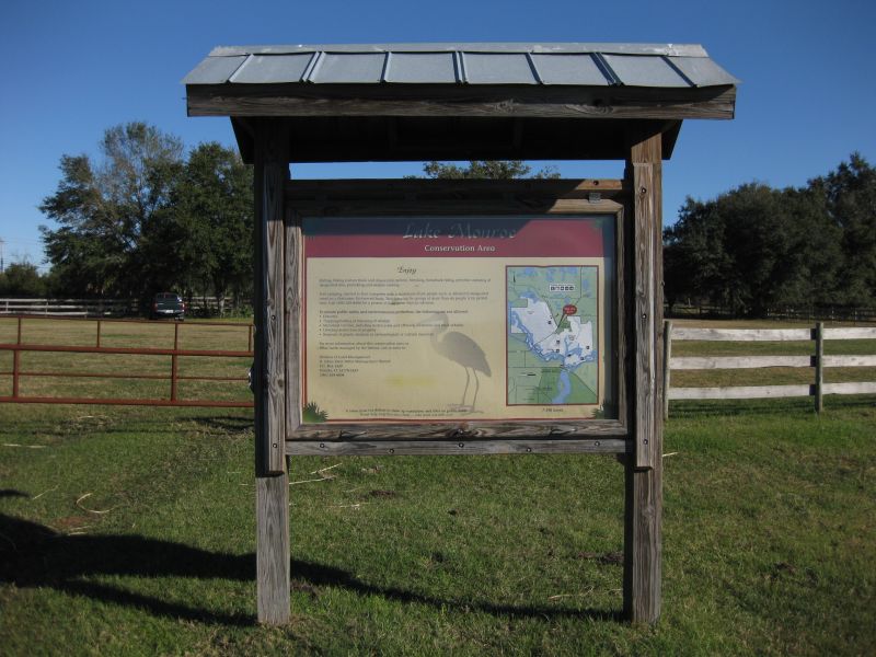
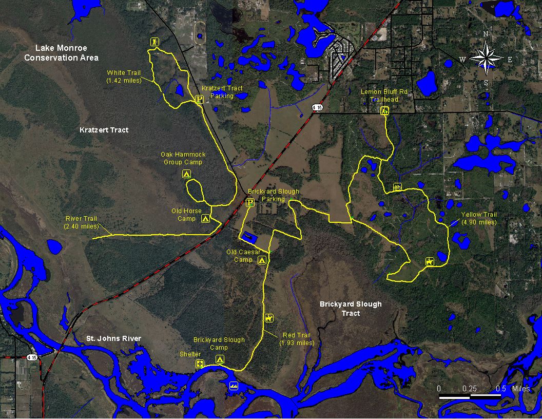
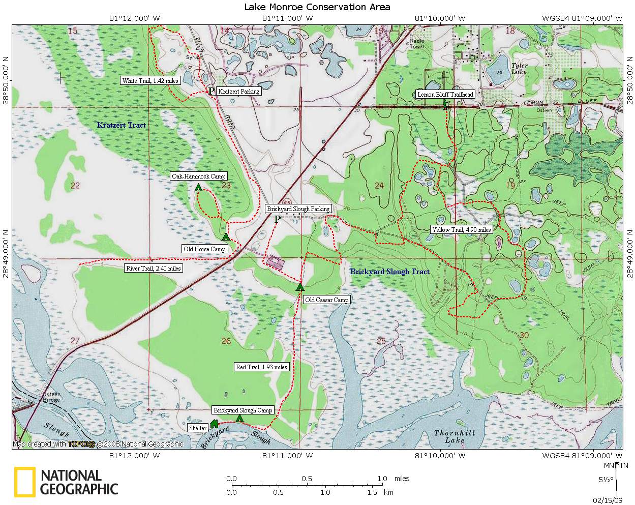
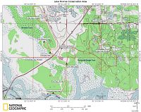
Lake Monroe Conservation Area
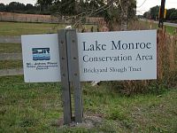
Lake Monroe Conservation Area is made up of 7,487 acres of
mostly wetlands
and it's split up into two tracts: the Brickyard Slough Tract (4,141
acres) and
the Kratzert Tract (3,346 acres). Both places offer opportunities to go
camping,
hiking, biking and horseback riding.
Location
Located along the shores of Lake Monroe in southwest Volusia
County, Florida
between Osteen and Sanford.
Directions
From exit 223 on I-95, go west towards Sanford on State
Road 46 for about
23.7 miles. Turn right on State Road 415 (Chuluota Rd) and head north
towards
Osteen. At about 3 miles you should see the main entrance to Lake
Monroe's
Brickyard Slough Tract on your right. If you continue down SR 415 a
short
distance and turn left on Reed Ellis Road, the entrance to the Kratzert
Tract
will be on your left about a mile up the road.
Note: There's a walk-in entrance to the Brickyard Slough
Tract off of Lemon
Bluff Road
Fees
None.
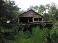
History
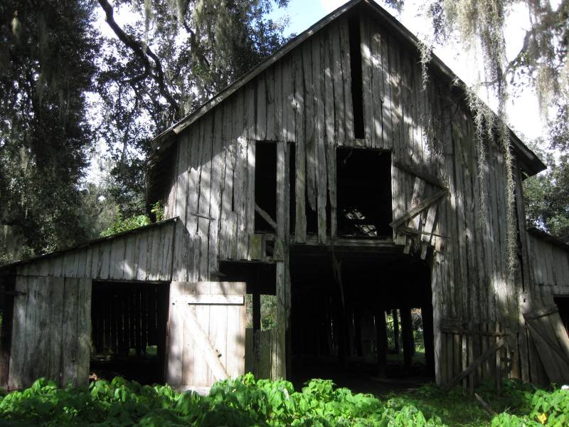
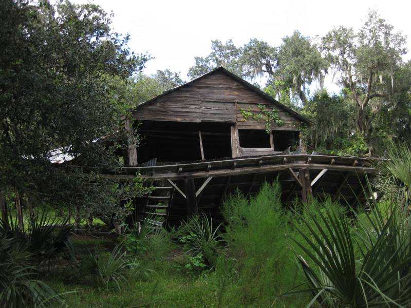
The Brickyard Slough Tract was formerly known as the Beck
Ranch. It was purchased by the state on February 14, 1995. About 997
acres of the tract was purchased by the Florida Department of
Transportation for mitigation. On April 9, 1997, another 227-acres of
the land was conveyed to Volusia County for a recreational park in
exchange for the 50% interest the county had on the Kratzert Tract. As
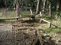
of 2009 a lot of the farm buildings and structures were still standing
although probably not for long. I hope they can preserve some of them.

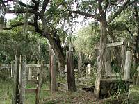
The Kratzert Tract was previously known at the Osteen Ranch.
It was named after Minnie Beck Kratzert, whose family owned the land
before the Water Management District and Volusia County acquired it on
December 29, 1987. There use to be an old corral and a campsite located
in the oak hammock near CR 415. A white blazed trail called
the Oak Hammock Trail use to take you right by it but that has since
been closed down.
There's also a number of shell middens scattered through out
the conservation area. For more information on them and other
archeological sites, see Jon Endonino's research report "The
Thornhill Lake Archaeological Research Project: 2005-2008".
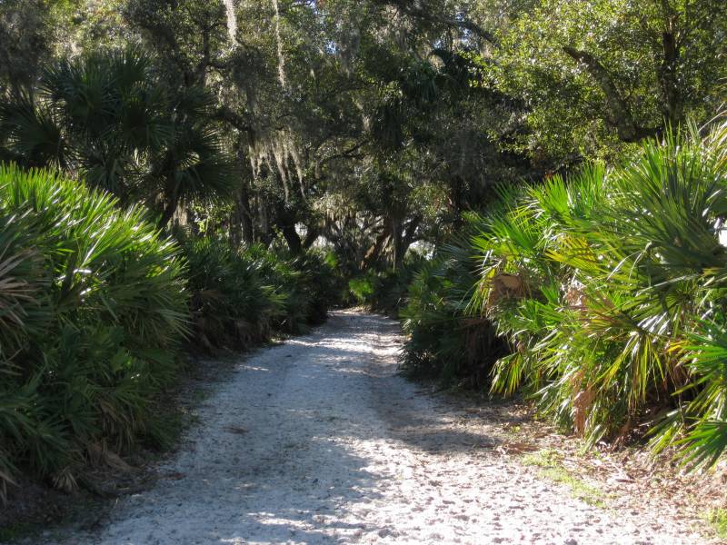
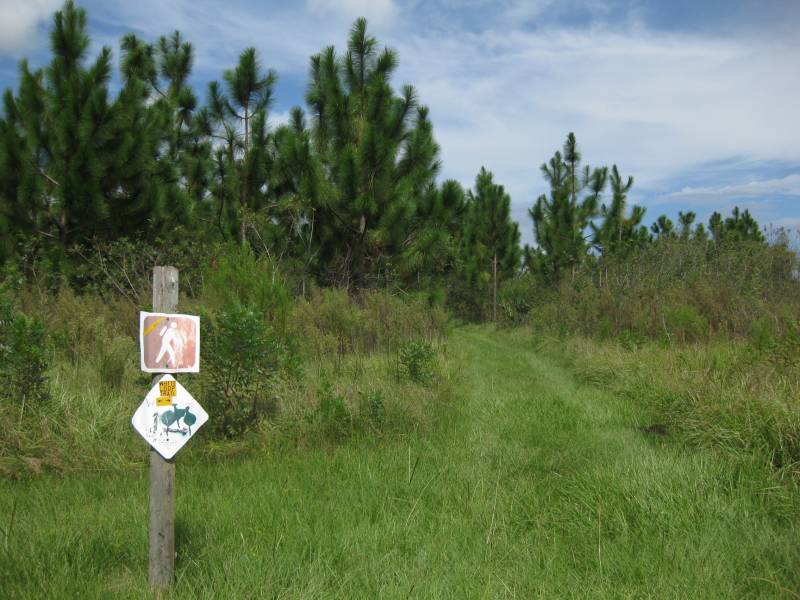
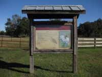
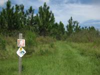
Hiking
Lake Monroe Conservation Area has numerous trails mostly
catered for horseback riding but you can hike on them as well. On the
Brickyard Slough side there's the 1.9 mile red-blazed trail that starts
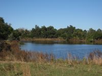
at the trailhead near CR 415. It passes by a man-made pond before
entering a beautiful oak hammock and the flood plains of the St. Johns
River.

There's also a 5.0 mile yellow-blazed loop trail. It splits
off from the red-blazed trail at about 0.6 miles from the trailhead.
Make sure you bring plenty of water as the trail tends to be out in the
open on old abandoned jeep trails. You can also get to the
yellow-blazed trail from the Lemon Bluff Road trailhead using a 0.5
mile access trail.
On the Kratzert side there use to be two white blazed
trails. One took you across an open field along Reed Ellis Road before
turning west and heading out towards Lake Monroe. That trail is no
longer being maintained. The other white blazed trail is about 1.4
miles long. It crosses an open field with planted pine trees, then
enters the woods before returning back to the parking lot.
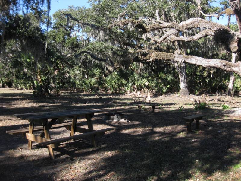
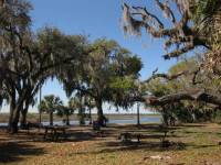
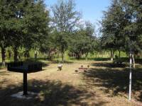
Camping
Lake Monroe Conservation Area currently has two
primitive campsites. One is located in the Brickyard Slough Tract near
the St. Johns River. It's available on a first-come,
first-served
basis. Up to four tent sites are allowed with no more than six persons
per site. It has three benches and a picnic table situated around a
fire ring with grill. The campsite can be accessed by boat along the
St. Johns River or by
land using the red-blazed trail. A beautiful view of the river and the
surrounding oak hammock makes this an ideal place to go camping. Just
watch out
for the stray cows that might wonder through camp during the night.
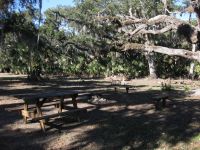
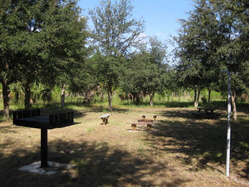
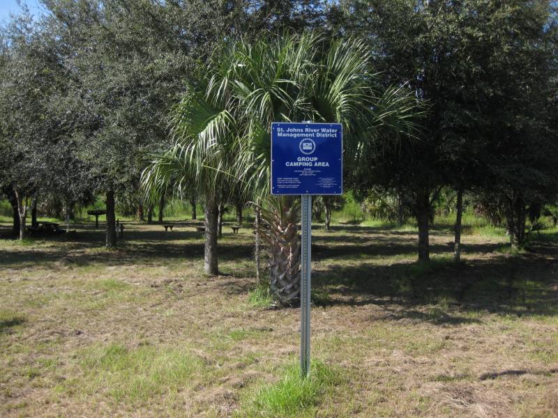
The other campsite is located in the Brickyard Slough Tract
near the Lemon
Bluff Road access trail. It's available for group reservations only. To
obtain a permit,
you should contact the District's Division of Land Management office at
(386)
329-4404 at least 7 days in advance. The campsite has a port-o-let,
picnic
table, a large grill, a pitcher pump and a fire ring with benches
around it.
In the past there were three other campsites: Horse Camp,
Caesar Camp and the Oak-Hammock Group Campsite. You can still find some
of their remains hidden back in the
woods.
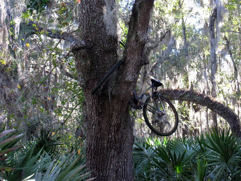
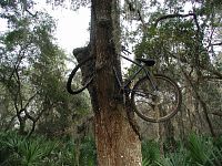
Biking
This old bike has been in this tree for as long as I've
known this place
(about 10+ years). You're welcome to bike on any of the trails. Just
make sure
you yield to hikers, equestrians and especially trees.
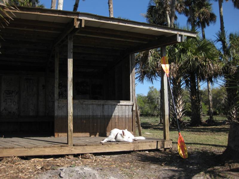
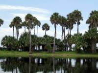
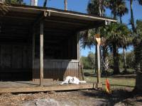
Boating
Although the Lake Monroe Conservation Area doesn't offer any
boat ramps or
canoe launch sites, it does have a foul weather shelter located along
the St.
Johns River about a mile east of the CR 415 Osteen Bridge. So if you
see an old
"shack" nestled among some tall palm trees overlooking the river, you
found the safe house.
Hunting
The Florida Fish and Wildlife Conservation Commission
manages hunting at Tosohatchee. For up-to-date information on regulations and
current
hunting schedules, please go to MyFWC.com.
| Hunting Schedule 2012 - 2013 |
| Archery |
Sep. 15 - Oct. 14 |
| Muzzle Gun |
Oct. 20 - Nov. 2 |
| General Gun |
Nov. 3 - Dec. 30 |
| Small Game | Dec. 31 - Mar. 3 |
| Spring Turkey |
Mar. 9 - 10, 16 - Apr. 21 |
Flowers

Common
Nightshade
Maps
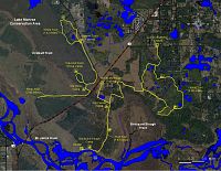
GPS Data
Local Weather

Additional Photos
Trail Notes
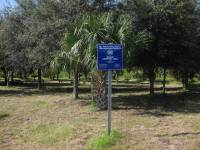
- 21-Sep-2009: Now that the FWC is managing the Kratzert
Tract, they have added two new hunter access points with parking along
Reed Ellis Road.
- 19-Sep-2009: Went and checked out the new group campsite
over by Lemon Bluff Road. I suspect the old one over at Kratzert Tract
wasn't compatible with the FWC regulations. Typically there's no
camping allowed during hunting season. Plus the FDOT is widening CR 415
which has to be factor.
Links
Last
updated on 13-Sep-2012