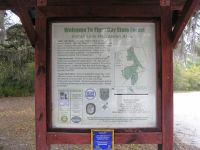
Tiger Bay State Forest
Tiger Bay State Forest consists of 27,315 acres of wetlands
with scattered
pine islands and a large pine ridge know as Rima Ridge. About 15,000 of
those
acres were burned severely during the wildfires of 1998. Forest
restoration is
underway and it will take a few more years before this place returns
back to
it's original glory. Don't worry. There are still plenty of places to
go hiking,
horseback riding and even do some primitive camping. Read on for
more details.

Location
Located in central Volusia County about 7 miles west of
Daytona Beach, Florida.
Directions
Southern Entrance: From I-95 take exit
261 and head west on U.S. Hwy 92 for about 4.5 miles. Turn right on
Indian Lake Road and drive north for about 1.75 miles. Entrance will be
straight ahead.
Northern Entrance: From I-95 take exit
268 and head west on SR 40 for about 5.1 miles. Entrance will be on
your left.
Hours
None posted.
Fees
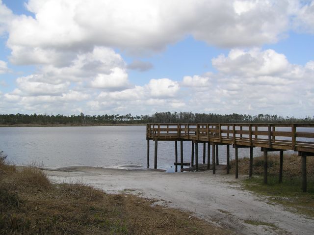
$2.00 per person, self-pay, at the Indian Lake Recreation
Area. Children under 6 can get in free.
For camping: $5.00 per night for 1-5 people.
Annual Pass: $30.00
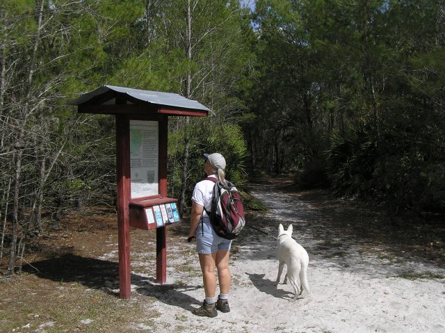
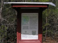
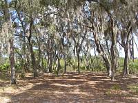
Hiking
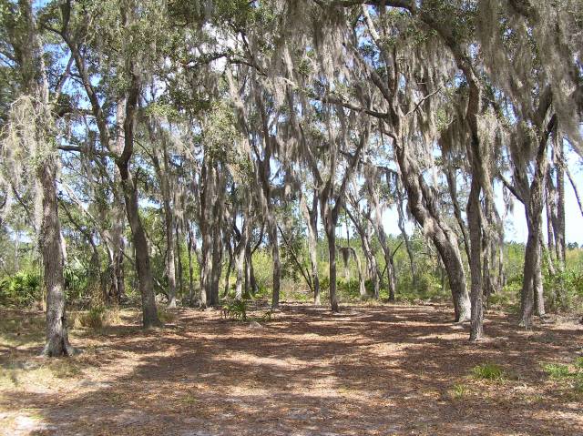
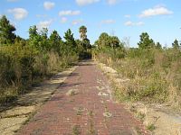
Tiger Bay
State Forest has one hiking trail called the Buncombe Hill Interpretive
Trail. It is a 1.9 mile loop trail with 22 interpretive points along
it. Starting at the Indian Lake Recreation Area, the trail winds
through planted pine forest, oak hammocks and sandy scrub areas.

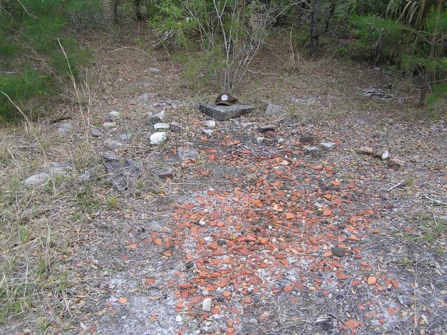
Along the
way you may notice a few pieces of terra-cotta lying on the ground.
These are from clay pots that were used to collected pine resign for
turpentine production back in the early 1900s. The trees have
all been harvested since then, so the chances of finding completely
intact pots
or old trees with cat-faces etched on them are probably pretty slim.


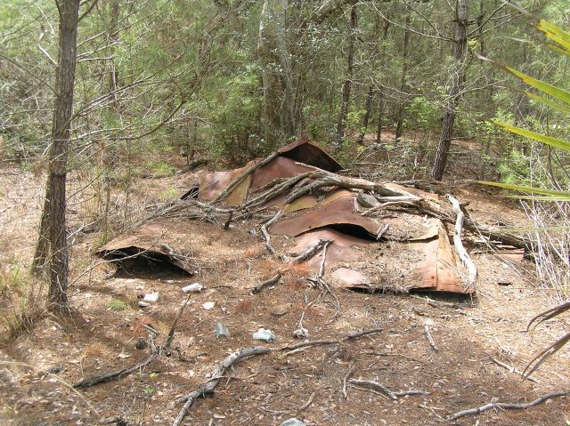
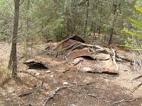
There's also
signs of an old homestead located near the north end of the trail. All
that remains is the foundation, pieces of a tin roof and an old gate.
Judging from all the melted glass that was in the
area, it must have burned down
some time ago.
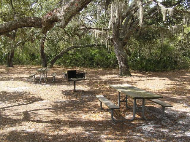
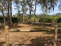
Camping
Primitive camping is only allowed in designated areas along
Rima Ridge Road. A State Forest Use Authorization
permit must be obtain in advance from the Tiger Bay State Forest Office
(see contact information below). You can have up to 5 people,
with one camper or two tents at each campsite. There are no bathrooms,
electrical hookups or drinking water, so make sure you come prepared.
Checkout time for campers is 2 P.M. Quiet time is
10 P.M. until sunrise. Camping is limited to 14 consecutive
days during any 30 day period. Pets must be on a leash no more than 10
feet long.
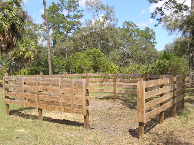
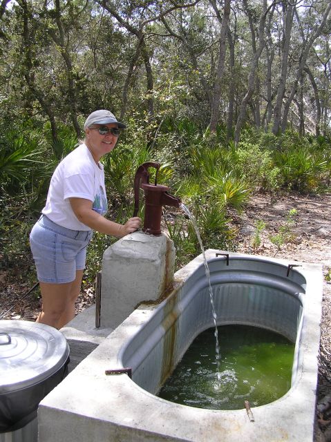
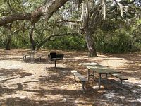
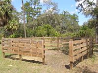
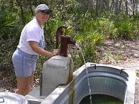
Shown below are some photos of the equestrian campsites.
Most of them are equipped with picnic tables and fire rings. There's
even a small corral and watering trough for the horses..
Historical Sights
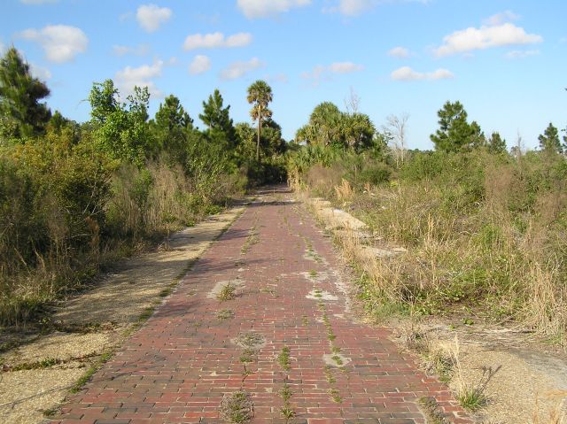
Part of the old Pershing Highway, that was constructed back
in 1917, can still be seen cutting through the swamps and pine lands of
Tiger Bay State Forest. Remarkably it's still in good shape. You can
access it from several points along US Hwy 92.
Hunting
This area is managed as a wildlife management area by the Florida
Fish and Wildlife Conservation Commission. For up-to-date
information on regulations and hunting schedules, see the hunting
regulations at Tiger
Bay WMA and Rima
Ridge Unit.
| Tiger Bay WMA
- Hunting
Schedule 2012 - 2013 |
| Archery |
Sep. 15 - Oct. 14 |
| Muzzle Loading Gun |
Oct. 20 - 22 |
| General Gun |
Nov. 3 - Dec. 30 |
| Small Game |
Dec. 31 - Mar. 3 |
| Spring Turkey |
Mar. 9 - 10, 16 - 19, 28 - 31,
Apr. 11 - 14 |
| Rima Ridge
Unit - Hunting
Schedule 2012 - 2013 |
| Archery |
Sep. 22 - Oct. 7 |
| Muzzle Loading Gun |
Oct. 26 - 28 |
| General Gun |
Nov. 10 - 18 |
| Small Game |
Nov. 22 - Dec. 30 |
| Spring Turkey |
Mar. 9 - 10, 16 - 18, 29 - 31,
Apr. 12 - 14 |
Maps
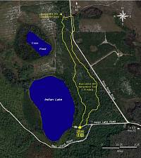
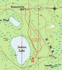
Color infrared aerial map
and Topographical map of
Buncombe Hill Trail.
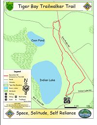
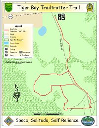
Trailwalker
and Trailtrotter
maps of Tiger Bay.
GPS Data
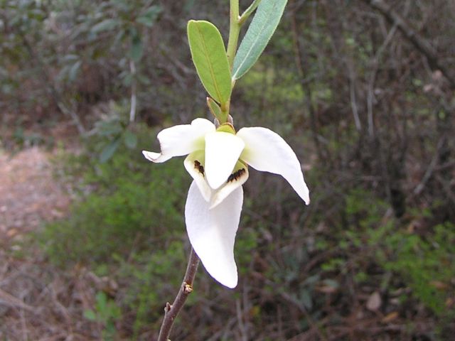
Flowers
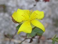
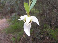
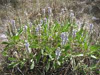
St.
John's Wort,
Netted Pawpaw and Skyblue
Lupine
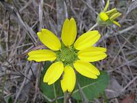
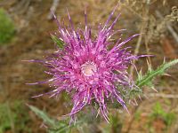
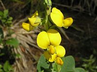
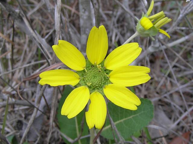
Florida
Greeneyes, Purple
Thistle and Showy
Rattlebox
Local Weather

Trail Reports
- 20-Oct-2009: The Buncombe Hill Interpretive Trail
has been freshly blazed and graded. Some of the trail had to be
rerouted around a scrub restoration area. This shortened the trail by
about a tenth of mile. GPS data and maps have been updated. Note: The
the day use fee is now $2 per person.
- 24-Mar-2007: The Buncombe Hill Interpretive Trail
is in good condition.
Contacts
- Tiger Bay State Forest
4316 W. International Speedway Blvd
Daytona Beach, FL 32124
(386) 226-0250
Links
Credits
- A big thanks to Geocacher
Genxrex for doing the leg work in mapping out the Buncombe
Hill Interpretive Trail with a GPS unit and providing some useful links
for the area. Thanks, Joel!
Last
updated on 13-Sep-2012