Charles H. Bronson State Forest
Charles H. Bronson State Forest
is one of Florida's newest
state forest. It was dedicated on October 20, 2010 to Charles
H. Bronson, a fifth generation Floridian and long term veteran of
public services including law enforcement, state senator and
agricultural commissioner. On March 25, 2011, the forest was
opened to the general public. Recreational activities include hiking,
camping, bird watching, horseback riding and seasonal hunting.


Entrance
signs and information kiosk
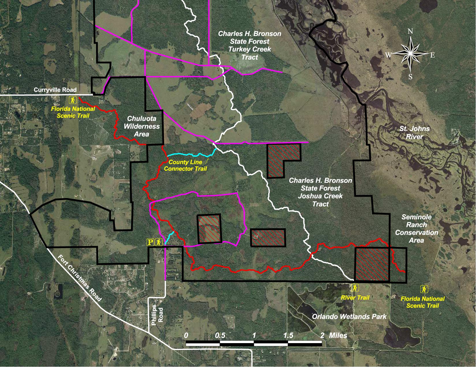
Location
The state forest is comprised of approximately 10,945 acres
located along the St. Johns River in southeastern Seminole County and
northeastern Orange County.
Directions
To
Joshua Creek Tract Trailhead:
From Interstate 95, take exit 79 and head west on State Road
50 for about 10.2 miles. Turn right at Fort Christmas Road and follow
the road for about 4 miles. Then turn right again onto Phillips Road
and follow it until it dead ends (about 1 mile). The entrance to
Charles H. Bronson State Forest is at the end of Phillips Road. Follow
dirt road until you reach the parking area. GPS coordinates: N28°
35.513 W81° 02.254.
To
Curryville Road Entrance:
From the intersection of State Road 50 and County Road 419
(Chuluota Rd), head north on CR 419 for about 5 miles. Turn right onto
Lake Mills Road and head east for about 1.8 miles. Turn right onto
Curryville Road and follow the road until dead ends about 2.7
miles. Parking is available at the nearby Chuluota Wilderness Area. GPS
coordinates: N28°
37.433 W81° 03.573.
Hours
The area is open from dawn to dusk, 365 days of the
year.
Entrance Fees
Self-pay at the entrance kiosk: $2 per person.
Hiking
A 7.7 mile section of the orange-blazed Florida National Scenic Trail
has
been routed through the Charles H. Bronson State Forest thanks to the
hard
work of volunteers from the Florida Trail Assoc and the
Student
Conservation Assoc. The section begins near the northeast boundary of
Orlando Wetlands Park and Seminole Ranch, and ends at the
southeast corner of the Chuluota Wilderness Area. A short (0.25 mile)
blue-blazed trail provides access from the main parking lot.
A new 12 mile white-blazed hiking trail, known as the River
Trail,
was also added by the Florida Trail Assoc. The trail starts at the
Orlando
Wetlands northern boundary, crosses four state forest tracts (Joshua
Creek, Turkey
Creek, Clontz and Yarborough) before ending at the
Econlockhatchee
River. A 0.85 mile blue-blazed trail, known as the
County Line Connector Trail, also provides access to the River Trail
from the Florida
National Scenic Trail near Chuluota Wilderness Area. In the
future, the River Trail will cross the Econlockhatchee River and merge
with the trails in the Kilbee Tract of the Little Big Econ State Forest.
 |
 |
 |
| Florida
Trail Sign |
Buscombe
Creek
Crossing |
Mitigation
Fence
Crossover |
 |
 |
 |
| Buscombe
Creek Sign |
Christmas
Creek |
Giant
Cypress Tree |
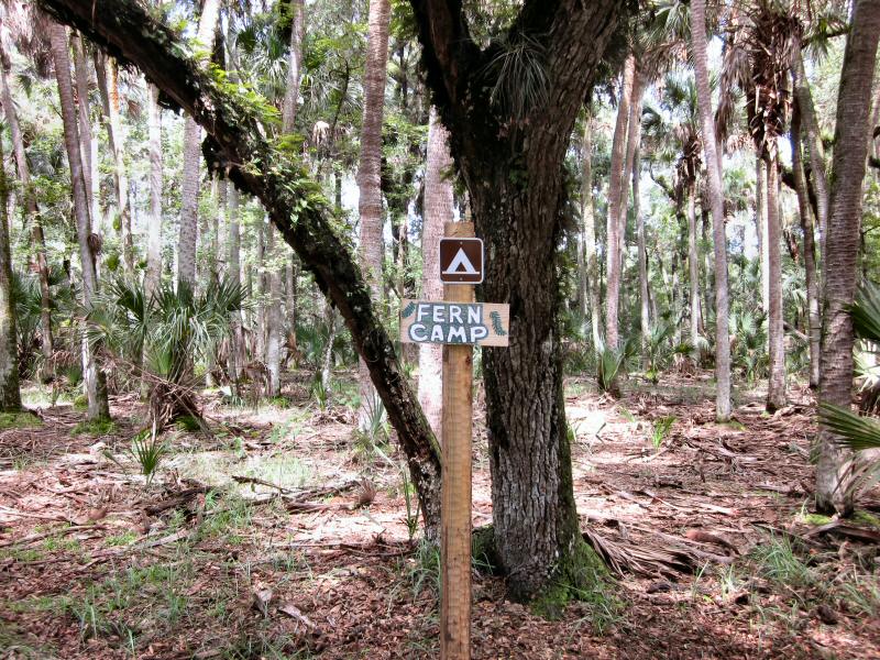
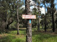
Camping
There are three primitive
campsites located in
the Charles H.
Bronson State Forest. Each is equipped with a fire ring and
some
cut logs to sit on. Two of the campsites, Fern and Joshua Creek, are
located along the Florida National Scenic Trail at coordinates N28°
35.224 W81° 00.557 and N28°
35.982 W81° 02.742. The other campsite, called the County
Line, is located along the River Trail at coordinates N28°
36.625 W81° 01.450.
 |
 |
| Joshua
Creek Campsite |
|
 |
 |
| Fern
Camp |
|
 |
 |
| County
Line Campsite |
|
Horseback Riding
The Charles H. Bronson State
Forest has over 23 miles of marked horseback riding trails covering
areas in Joshua Creek, Turkey Creek, Clontz and Yarborough
Tracts.
There's also a trail that goes to the Orlando Wetlands Park and another
that takes you out to the Culpepper Bend day-use pavilion on
the
Econlockhatchee River. Ample horse trailer parking is available at the
Joshua Creek Tract and Curryville Road trailheads. Water for horses can
be an issue since there are no established water troughs on the trails.
During
prolong drought periods most of the creeks, including Christmas,
Joshua, Buscombe and Turkey Creek, will completely dry up. Also you
should be aware that this state forest does have active cattle leases.
Please close gates behind you if you have to open any.
State Forest Rules: All horses must be accompanied by a
current 1-year negative Coggins report. No person shall ride or lead a
horse off of the designated horseback riding trails. All
equestrian riders under the age of 16 must wear a certified helmet.
Hunting
The Florida Fish and Wildlife Conservation Commission
manages hunting at Charles H.
Bronson State Forest. For up-to-date information on regulations and
current
hunting schedules, please go to MyFWC.com.
| Hunting Schedule 2013 - 2014 |
| Archery |
Sep. 27 - Oct. 19 |
| Muzzle Gun |
Oct. 25 - 27, Nov. 1 - 3 |
| General Gun |
Nov. 8 - 10, 15 - 17, 29 - Dec. 1 |
| Small Game |
Dec. 7 - 15, Jan. 4 - 10 |
| Spring Turkey |
Mar. 8 - 9, 15 - 18, 21 - 24, 28 - 31 |
Maps
These are some of the maps for the Charles H. Bronson
State
Forest. You can enlarge them by clicking on the thumbnail
image. Printer versions of these maps can also be downloaded and
printed using Adobe
Reader.
Two topographical maps
showing the northern half and the southern half of the Charles H.
Bronson State Forest. Map features include hiking trails, roads
and points of interests.
Aerial photo maps showing hiking trails and roads within the Charles
H. Bronson State Forest.
A photograph of the
large map located inside the kiosk at the Joshua Creek Trailhead.

Google Map of Charles H. Bronson
State Forest showing hiking trails and photos.

Horse Trail Map available at the information kiosk.
GPS Data
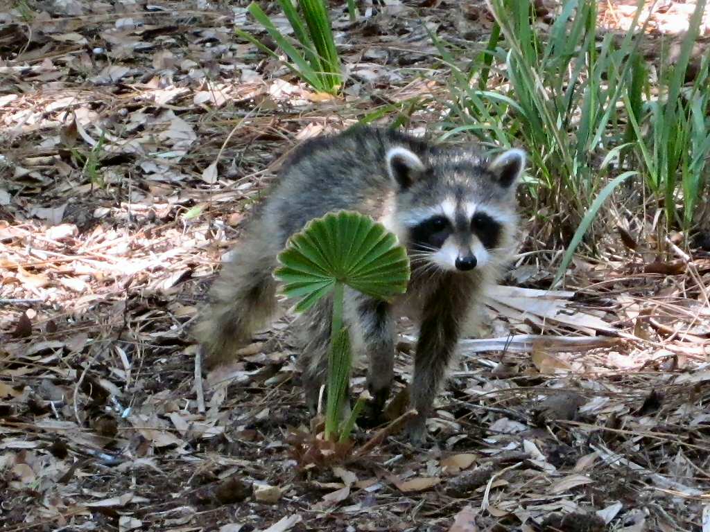
Wildlife
 |
 |
| Baby
Raccoon |
White
Tail Deer |
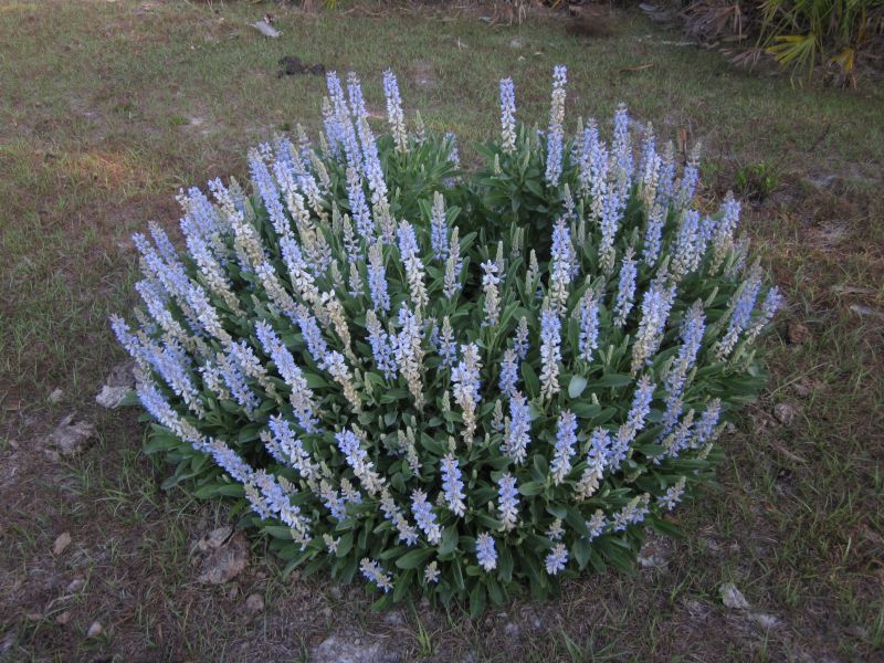
Flowers
Local Weather

Trail Notes
- 2013-04-14: An extension has been added to the plankwalk over by Joshua Creek.
- 2012-04-18: A 6.5 mile section of the River Trail
is now
finished in the Turkey Creek and Clontz tract. Nine water crossings and
six fence styles were created by volunteers of the Florida Trail
Association.
- 2011-09-10: Three new primitive campsites were
added
thanks to the hard working members of the FTA Central Florida Chapter.
See
camping section for more detalis.
- 2012-11-02:
The FNST has been rerouted around some wet areas between South
Slough and Christmas Creek. Trail is now 0.25 miles shorter. The
River Trail was also rerouted around a muddy area just north of the
Seminole / Orange County line. A fence stile had to be relocated and a
new water crossing built.
Links
Last
updated on 18-Nov-2013.